New: wave height, direction and period, with 7-day forecasts.

About the new wave layer
FishMap

Ocean data for offshore fishing

Read the sea before you leave port.

FishMap puts currents, waves, sea temperature and fish habitat on one chart, with 7-day forecasts and an AI Captain that answers in plain words. A desktop app for macOS, Windows and Linux.

  • 30 days, every feature
  • No card needed
  • Works offline at sea
of forecasts
7 days
of forecasts
Currents, waves, temperature, salinity
fish species
9
fish species
Habitat probability, every day
languages
3
languages
English, Vietnamese, Thai
free trial
30 days
free trial
Every feature, no card

What FishMap shows you

Everything you check before a trip, on one screen

Ocean layers, fish habitat, weather and your own fishing data sit on one chart, so you compare them instead of switching between apps.
  • Currents and eddies

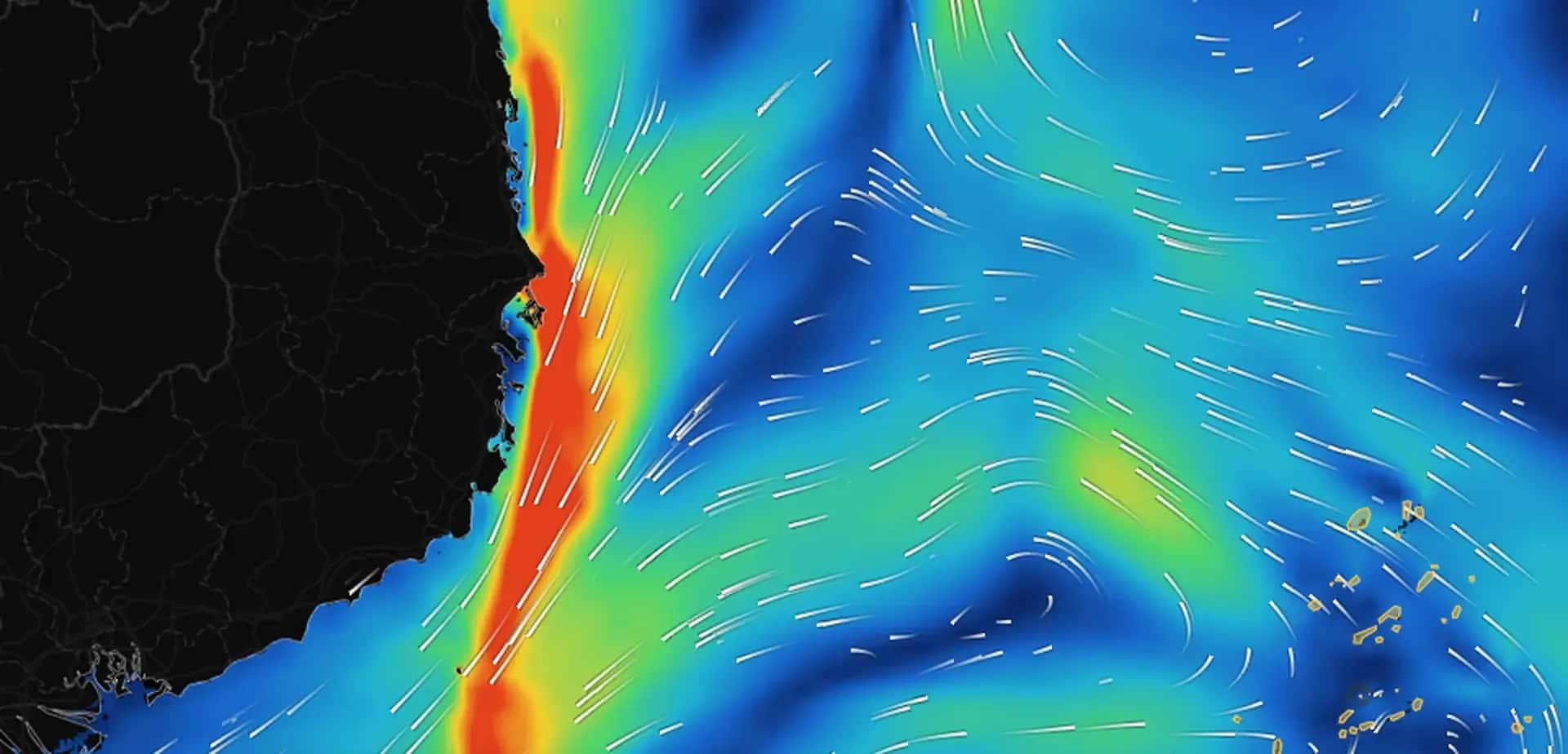
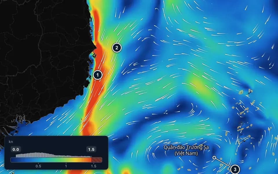
    Speed colours and moving particles show where water runs strong, where currents meet and where eddies turn.
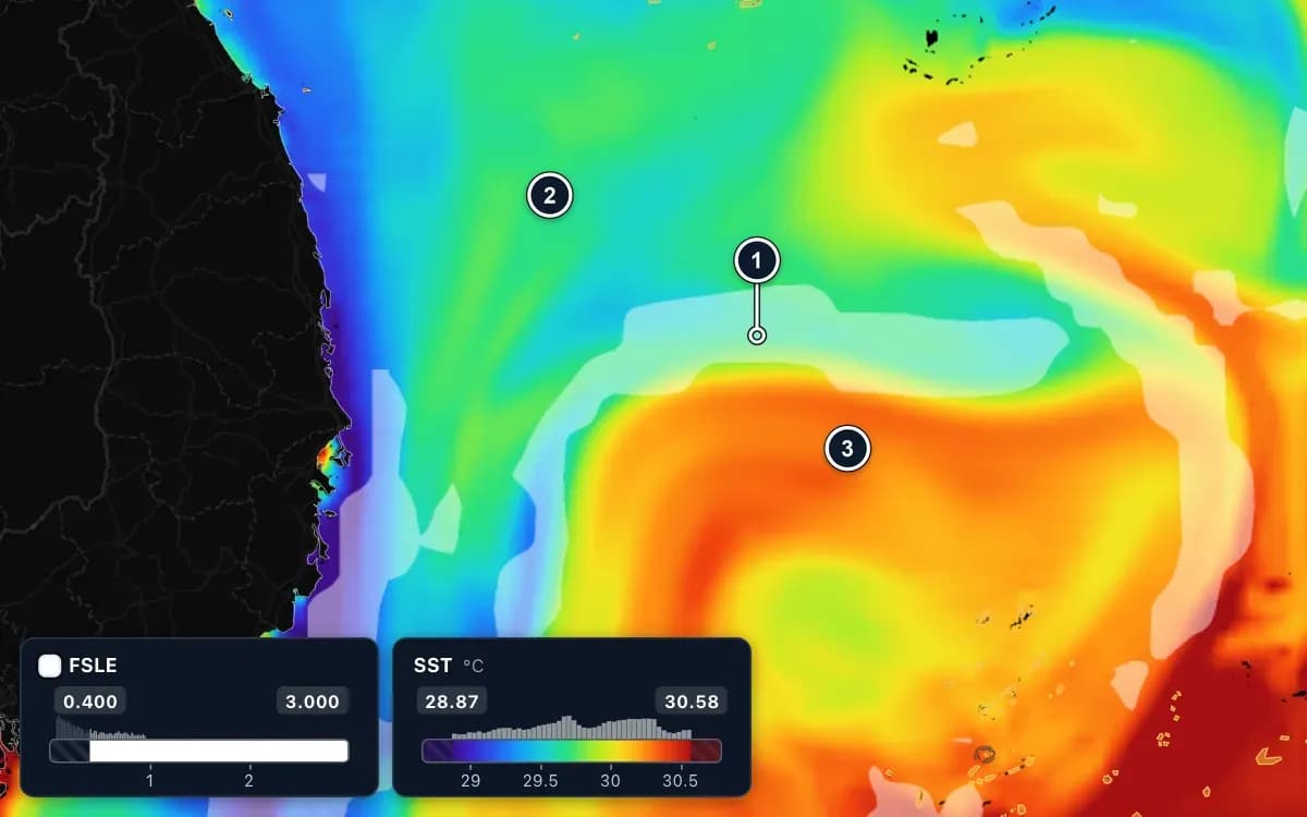
  • The same waters coloured by water temperature: the white FSLE band runs along the boundary between colder green and blue water to the north and warmer orange and red water to the south. Three numbered markers, 1 to 3.

    Temperature and fronts

    Sea temperature at the surface and below, and the fronts where warm and cool water meet: the edges fish follow.
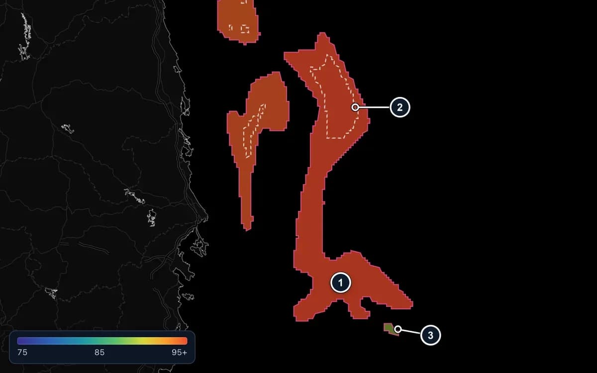
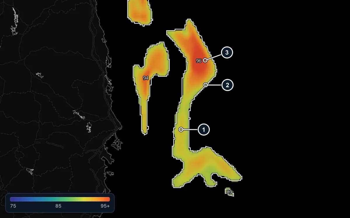
  • The same waters in the Zones view: each good area is outlined and filled with one colour for its score, the large zone red and a small one green; a white dashed line runs inside the red zone. Numbered markers 1 to 3.

    Fish habitat, 9 species

    A daily score of how well the water suits each species, from tuna to mackerel and squid.
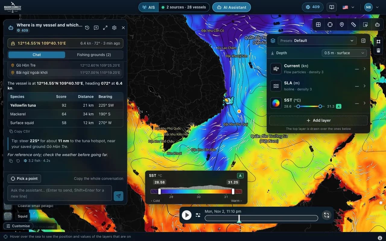
  • The AI Captain answering where the vessel is and which nearby water suits yellowfin tuna, mackerel and squid, with distance and bearing.

    AI Captain

    Ask about a point, a zone or your saved grounds and get an answer with distances, bearings and the data behind it.
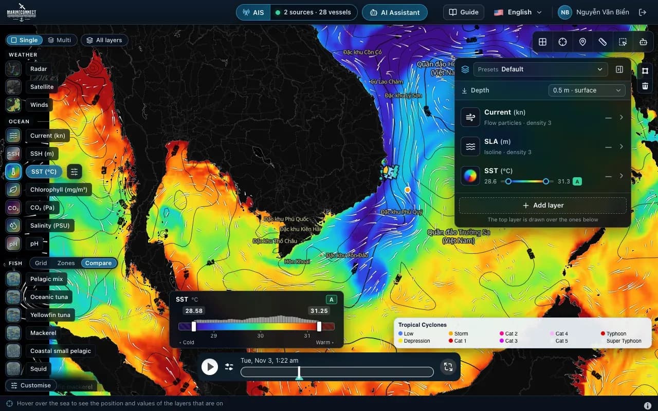
  • FishMap desktop app: sea surface temperature with current particles off southern Vietnam, the layer rail on the left and the ocean panel on the right.

    Live weather

    Radar, satellite, wind, waves and tropical storms on the same chart as your ocean layers.
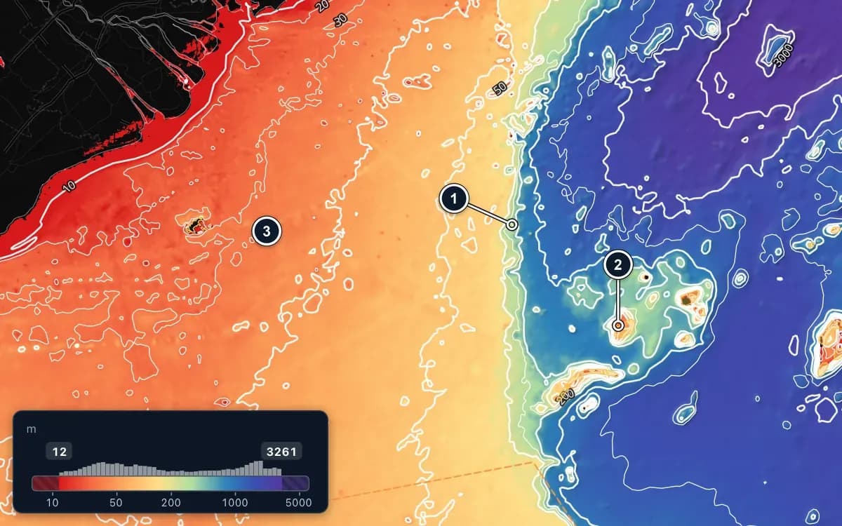
  • Seabed depth map off southern Vietnam: a wide shallow shelf in red, orange and yellow on the left; in the middle the white depth contours crowd together where the bottom drops into deep blue and purple water; to the south-east, banks rise out of the deep water. Three numbered markers, 1 to 3.

    Ready when the signal drops

    Download the sea data for your trip before you leave. The base map, AIS and your spot book keep working offshore.

Currents

Watch the water move

Included inEvery plan

  • Speed in knots, with flow particles that follow the current
  • 7-day forecast on the timeline
  • Stack it over temperature or sea level to find edges

What to look for

  1. 1. A strong current along the coast: the streaks move fastest here.
  2. 2. Where currents meet: meeting zones like this often gather bait and fish.
  3. 3. An eddy: water circles around a calm centre. Fish often follow its edge.
How to read currents
Animation of currents off south-central Vietnam: a red band along the coast is a strong southward current, white streaks drift with the water and circle in a small eddy to the south. Three numbered markers, 1 to 3.

How it works

From download to your first trip plan in minutes

  1. Step 1

    Download FishMap

    Install the desktop app on macOS, Windows or Linux. One account works on two computers.

  2. Step 2

    Sign in: 30 days free

    Your trial starts at the first sign-in, with every layer, live weather and fish for the AI Captain. No card needed.

  3. Step 3

    Plan your trip

    Check the weather window, turn on your species, compare the water and download the data before you leave.

Plans

Pick the plan that fits how you fish

Start with 30 days of every feature. Then pay by the month or save two months with a yearly plan.

  • $38/month

    $380 billed once a year

    • Currents, waves, depth and sea temperature
  • AI Captain

    Most popular

    $77/month

    $770 billed once a year

    • Currents, waves, depth and sea temperature
    • AI Captain assistant
  • $192/month

    $1,920 billed once a year

    • Currents, waves, depth and sea temperature
    • Advanced ocean: temperature at depth, salinity, chlorophyll, sea level anomaly and fronts
    • Fish habitat probability for 9 species
    • Live weather: radar, satellite, wind, waves and storms
    • AI Captain assistant

30 days with every feature, free.

Compare plans

News and guides

Learn the water, keep up with the app

All guides
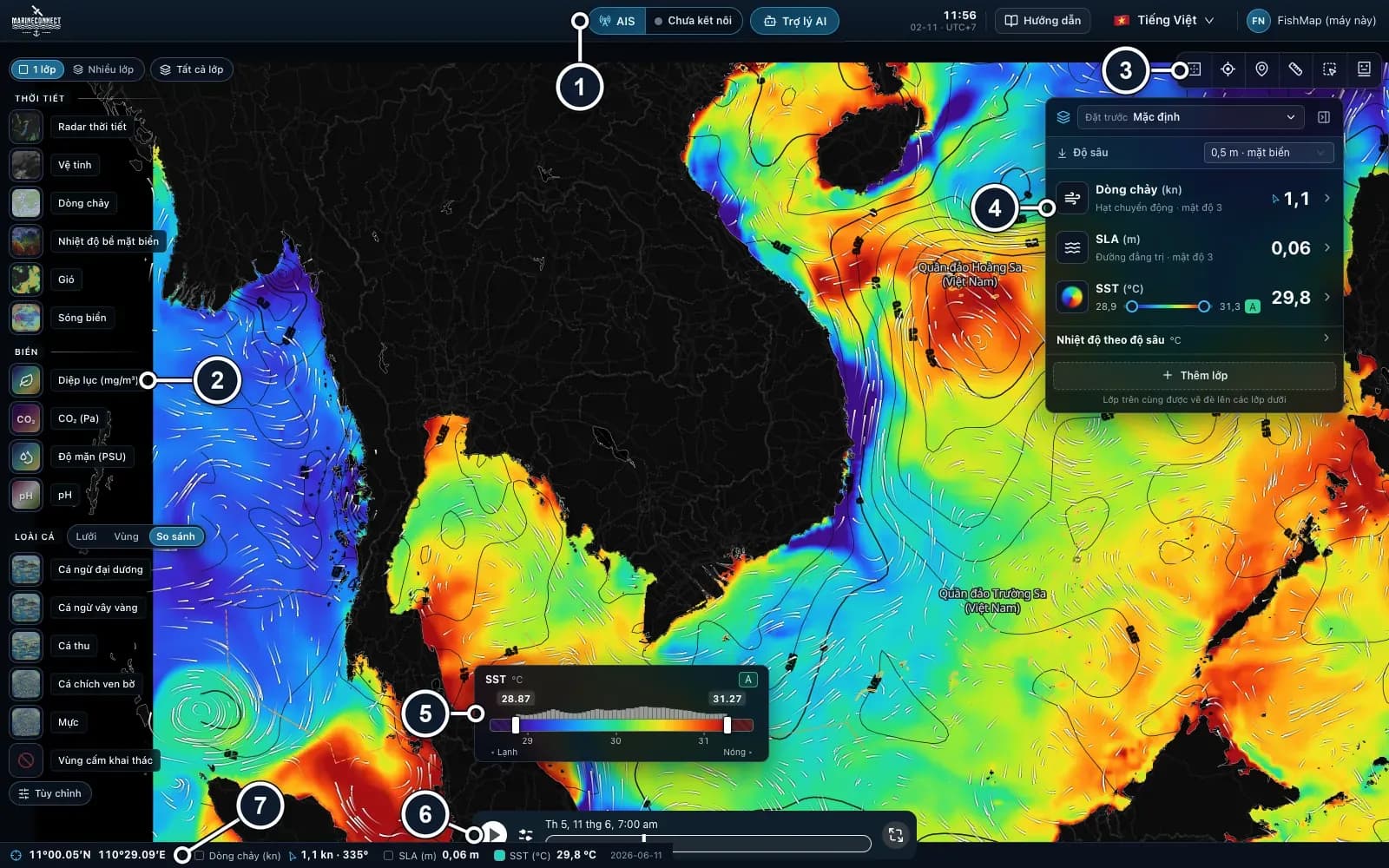
  • The whole FishMap window: the sea map in the middle; the top bar; the layer rail on the left edge; the map tools and the Ocean panel on the right; the colour legend, the timeline and the status bar at the bottom. Numbered markers 1 to 7.Guides · Getting started

    · 3 min read

    Getting started with FishMap

    Download the desktop app, sign in and your 30-day free trial starts. Then take a first look at the screen and plan your first trip.
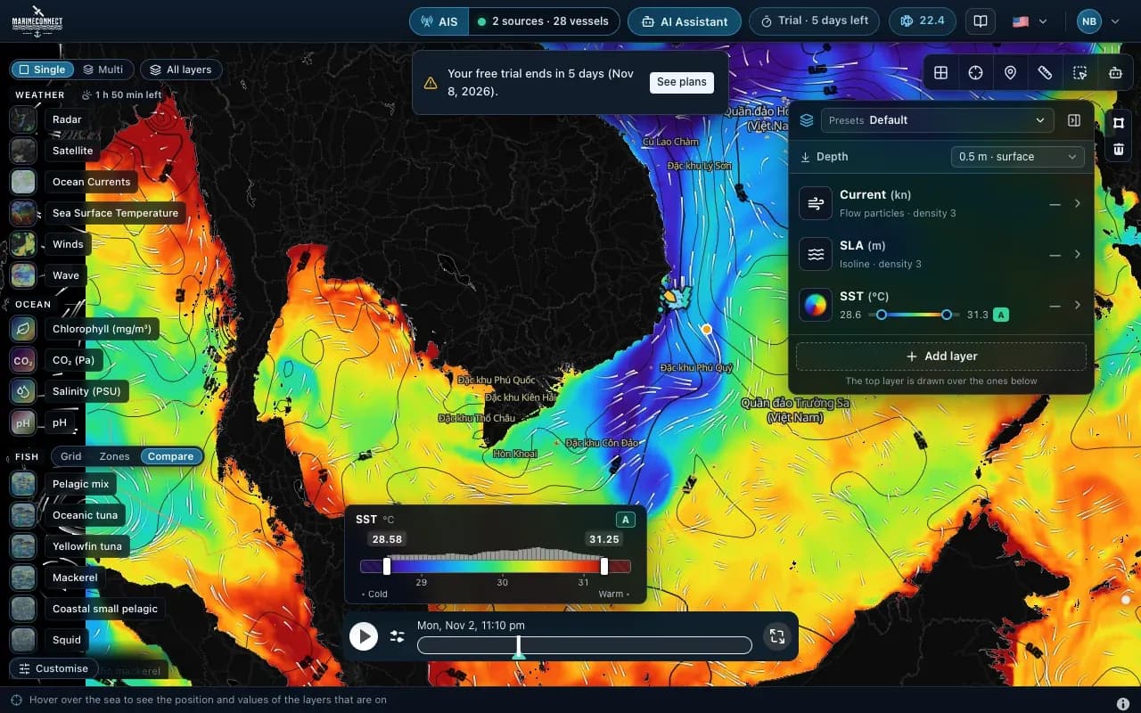
  • The map during the free trial, with the trial badge and a reminder of the days left.Guides · Getting started

    · 2 min read

    Installing FishMap on macOS

    Drag the app into Applications, clear the macOS block with one Terminal command if needed, and answer the Keychain prompt once.

  • The AI Captain answering where the vessel is and which nearby water suits yellowfin tuna, mackerel and squid, with distance and bearing.Guides · AI Captain

    · 3 min read

    How to ask the AI Captain

    How to ask good questions, what an answer costs in fish, how to ask about one exact point, and how to save your fishing grounds.

Try FishMap free for 30 days

Every feature, no card. Download the app, sign in and plan your next trip with better information.